Tuesday, March 1, 2011

Bethsaida


Also known as et-Tell, Beth-Saida, Bethsaida Julia, Julia, Julias, Julias-Bethsaida
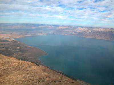
Plain of Bethsaida
The northeastern shore of the Sea of Galilee is a fertile plain where the feeding of the 5,000 likely took place.  Israeli maps and excavators currently locate the New Testament city of Bethsaida at an ancient ruin known as "et-Tell."  The excavation team, headed by Rami Arav, is insistent that this site be identified with ancient Bethsaida.  Others suggest that Bethsaida may be better located at el-Araj near the lakeshore.

Aerial View
There are many problems with the identification of et-Tell with Bethsaida, including:
  • Distance from the Sea of Galilee
  • Elevation of the site, about 20 feet (7 m) above the level of the lake in ancient times
  • Lack of ancient remains from the 1st century A.D., including significant pottery and coins
  • Lack of buildings from the New Testament period.  After nearly 20 years of digging, excavators have identified only one Roman period house and another building they identify as a Roman temple.  This latter identification is dubious.
In short, there is little to commend this site as being the Bethsaida mentioned by Josephus and the Bible.  For more of the excavators' perspective, see the links below.  For more evidence against this identification, see Rainey and Notley, The Sacred Bridge, pp. 356-59. 

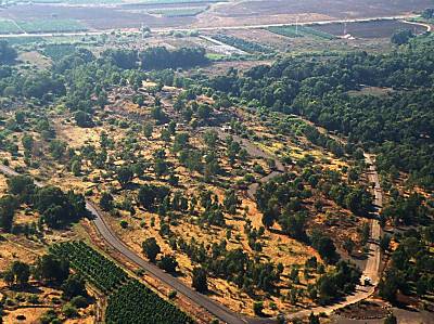
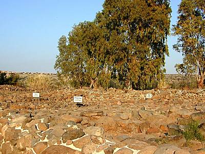
House of the Fisherman
The most impressive remains at this site are the Iron Age gate and two large Hellenistic houses.  The House of the Fisherman measures 4,300 sq. feet, and is believed to be a fisherman's home based on the discovery of two types of lead net weights, a round lead weight of the so-called musket type, and a long, crooked needle.  Among the coins discovered in the house were two silver didrachmae of Demetrius II.

House of Winemaker
This house (2,700 square feet) included an undisturbed wine cellar with four complete Hellenistic jars.  In addition, a gold earring with the picture of an animal was found, as well as numerous examples of expensive imported vessels. A hook and some anchors were found in the house, as were three iron sickles.
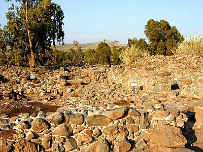
Acco, Ptolemais, Acre

Acco, Ptolemais, Acre

Also known as Tel 'Akko/Acco, Tel/Tell el-Fukhkhar, Tell el-Fukhar, Acca, Accho, Acon, Acre, Acri, Ake, 'Akka, Akko, Antiochenes, Antiochia Ptolemais, Ptolemais Antiochenes, Ocina, St. Jean d'Acre
Acco lighthouse
 
Port City of Acco
Acco is only referenced once in the Bible by this name. In Judges 1:31, it is referred to as one of the places the Israelites failed to hold. In the New Testament, Acco was known as Ptolemais, and was one of the stops on Paul’s final return to Jerusalem (Acts 21:7). Ptolemais was situated on the main sea and land route in ancient times. It served as the main port of the region until Caesarea was built. Herod the Great received Augustus Caesar at this site, since Caesarea had not yet been completed. Vespasian first docked at Ptolemais when he came to subdue the First Jewish Revolt. Later, the Arab inhabitants changed the name back to “Acco.”

Defensive Walls
Acco (then known as Acre) was conquered by the Crusaders in 1104 A.D. They held Acco even after having lost control of Jerusalem in 1187. It then became the greatest port of their empire. The Mamluks ended Crusader rule in Acco in 1291. Napoleon understood the strategic value of this site. He claimed that if this port city had fallen to him, “the world would have been mine.” His 1799 siege failed.
Western wall of Acco fortress

Templars Tunnel in Acco
Templars Tunnel
Five hundred years after the Crusaders left, the Druze prince Fakhr ad-Din rebuilt the city. The Muslims could not destroy the Crusader’s underground labyrinth, so it can still be visited today. These buildings were originally above-ground, but Al-Jazzar simply built his city over them. The excavations were stopped for fear that the Arab town might collapse. Today, most of the Crusader city is still buried. Only the area that is originally known as the “Hospitaller’s Quarter” is open.

Al-Jazzer Mosque
The emerald-domed, 18th-century Mosque of Al-Jazzar is the third largest mosque in Israel. Construction began in 1781, on the site of San Croce, the original Christian cathedral of Acco.
The Roman columns inside were taken from Caesarea. Inside the mosque is a shrine containing a hair from the beard of Muhammad. Other hairs from Muhammad’s beard can be seen in Istanbul, Turkey.
Al Jazzer mosque in Acco at dusk

Sunset from Acco

Dead sea

Dead Sea

Also known as Bahr Lut, Eastern Sea, Lake of Asphalt, Salt Sea, “Sea of Sodom and Gomorrah,” Sea of the Arabah, Sea of the Devil, “Sea of the Plain,” Sea of Zoar, Stinking Lake
Names of the Sea
Known in the Bible as the "Salt Sea" or the "Sea of the Arabah," this inland body of water is appropriately named because its high mineral content allows nothing to live in its waters.  Other post-biblical names for the Dead Sea include the "Sea of Sodom," the "Sea of Lot," the "Sea of Asphalt" and the "Stinking Sea."  In the Crusader period, it was sometimes called the "Devil's Sea."  All of these names reflect something of the nature of this lake.

Biblical Period
The Dead Sea, unlike the Sea of Galilee to the north, does not figure prominently in the biblical narratives.  Its most important role was as a barrier, blocking traffic to Judah from the east.  An advancing army of Ammonites and Moabites apparently crossed a shallow part of the Dead Sea on their way to attack King Jehoshaphat (2 Chron 20).  Ezekiel has prophesied that one day the Dead Sea will be fresh water and fishermen will spread their nets along the shore.
En Gedi palms and Dead Sea

Dead Sea shoreline
Lowest Point
The Dead Sea is located in the Syro-African Rift, a 4000-mile fault line in the earth's crust.  The lowest point of dry land on earth is the shoreline of the Dead Sea at 1300 feet below sea level.  That the lake is at the lowest point means that water does not drain from this lake.  Daily 7 million tons of water evaporate but the minerals remain, causing the salt content to increase.  Figures for the Dead Sea's salinity today range from 26-35%.  

Mineral-Rich
Nearly ten times as salty as the world's oceans and twice as saline as the Great Salt Lake in Utah, the Dead Sea is rich with minerals.  The Dead Sea Works company on the southwest side of the lake employs 1600 people around the clock to harvest the valuable minerals from the water.  Potash is the most valuable of those extracted today and is used in the manufacture of fertilizer.  The best article on the minerals in the Dead Sea is in the Encyclopedia Britannica.
Dead Sea rocks covered with salt

Healthy Water
The unique concentration of the Dead Sea waters has long been known to have medicinal value.  Aristotle, Queen of Sheba, King Solomon and Cleopatra were all familiar with this and modern doctors as well often prescribe patients with skin ailments to soak in the waters of the Dead Sea.  Because of the dropping level of the Dead Sea, the southern end is no longer under water, except for that which is channeled by aqueducts for the purpose of extracting minerals.
Related Websites
At BiblePlaces.com, see the related sites of En Gedi, Masada, Qumran, Qumran Caves, Jericho, and the Judean Wilderness.
Dead Sea (Dead Sea Tourist Board and Dead Sea Hotel Association)  The official site for Dead Sea Tourism.   Hosts categories such as "Fast Facts and History," "Sights and Sites," "Medicine/Research," "Photogallery," and even "Travel Themes."
Dead Sea (Walking in Their Sandals)  Gives easy-to-read information on the location, biblical significance, etc.  Features links to photographs and on-line scripture references. 
Dead Sea and Wilderness of Judea (Christian Travel Study Program)  Discusses the barrenness of the Judean Wilderness as a place of solitude, even refuge, in both biblical and modern times.  Gives a brief description of the Dead Sea in this context. 
Dead Sea (Catholic Encyclopedia)  Highlights the biblical significance of the site while clearly describing geographical and physical properties of the sea and surrounding area.
The Dead Sea Research Center  The home page for the Dead Sea Research Center.  A great resource for studying the medical potential of the Dead Sea area.  Includes a "News & Research link," a "Publications" bibliography, and an "Ask the Doctor" feature.
Dead Sea (Extreme Science)  An upbeat, scientific description of the Sea, answering common question such as, "why is the Dead Sea so salty?"  Reflects an evolutionary bias.
Madaba Mosaic Map: The Dead Sea (Franciscan Cyberspot)  Features the Dead Sea portion of the 6th century Madaba Map.  See more detail at their Virtual Travel link.
Dead Sea keeps falling (BBC News)  An interesting news story reporting on the findings of the European Space Agency in their survey of the region.
Dead Sea 'to disappear by 2050' (BBC News)  "Environmentalists in Jordan are warning that the Dead Sea will disappear by the year 2050 if its level continues to drop at the current rate."  Presents the problem and proposed solutions. 
Dead Sea (Dead Sea Scrolls Home Page, Personal Page)  Observes the Dead Sea in its geographical context, including references to nearby sites and insight into how the climate of the region affected the preservation of the Dead Sea Scrolls.  
Welcome to the Dead Sea (inisrael.com)  A site for tourists with basic information about the area and links to hotels, cars, and other travelers resources.
For Dead Sea, a Slow and Seemingly Inexorable Death (Washington Post)  Fascinating article on the steady decline of the water level of the Dead Sea, with numerous useful facts and at least one stupid quote.